Here are some of the photos I took. Unfortunately, I couldn't get to a computer that would upload my pictures sooner, and I don't remember what many of them are, other than kind of cool. I'll identify those I do remember.
This is what I saw as I sat at my campsite at Refugio State Beach. The hiker/biker spots were down almost on the beach. It was a little cold after dark, but it was worth it, for hearing the surf all night.
These three I took as I sat in a rest stop just before I went into a tunnel, on my way from Refugio to Lompoc. Unfortunately, I couldn't get any without evidence of Man's existence. Right after the tunnel, which is right after these pictures, I struggled up my first major hill. It was 1000 feet high, and almost 3 miles going up it. I was glad to stay in Lompoc after that hill. After leaving Lompoc, there was another hill just about as high.
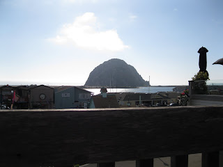
These are from behind the restaurant at Moro Bay. I had been planning to eat breakfast and then take off, but I decided I needed a rest after I looked out on the bay. The rock in the last picture is Moro Rock. You can see it better from the town, which is about 100 feet from the campground.
You can also see the sail boats much better from the town. Moro Bay is a protected bay, protected from the vagaries of the Pacific ocean just beyond the line of dunes that ends with Moro Rock. Lots of sail boats anchor here.


No comments:
Post a Comment